The SEG Advanced Modeling Corporation (SEAM)
SEAM is the research arm of the Society of Exploration Geophysicists (SEG). We unite energy companies, researchers, and government partners to design advanced geophysical models that tackle today’s most complex subsurface challenges—delivering unparalleled technical insight and fueling innovation across the geosciences.
Each SEAM project is shaped by participating companies for maximum real-world relevance. Cost-sharing minimizes risk and expense, while collaborative expertise yields more accurate and impactful solutions.
SEAM Project Portfolio
CO2 Sequestration (Ongoing)
Understanding the value of geophysical information in CO2 capture and storage.


Available Now!
Artificial Intelligence
Pioneering the industry’s first artificial intelligence (AI) and machine learning (ML)-ready benchmark datasets.
Life of Field (LoF)
4D Subsurface Simulation
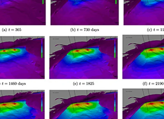

Time Lapse Pilot
4D Pressure Prediction Through Improved Seismic Imaging and Reservoir Characterization
Pressure Prediction
SEAM Pressure Prediction and Hazard Avoidance Through Improved Seismic Imaging

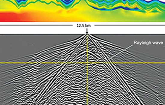
Foothills Model
Land Seismic Challenges: Foothills Model
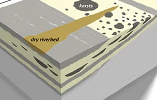
Arid Model
Land Seismic Challenges: Arid Model

Barrett Unconventional Model
Land Seismic Challenges: Barrett Unconventional Model
Subsalt Imaging
Phase I: Subsalt Imaging in Tertiary Basins

Ready to shape the next SEAM project? Questions?
Join industry leaders working together to solve today’s most complex geophysical challenges.