SEAM provides free access to selected data sets from past projects to accelerate research, education, and technology development across the global geoscience community.
Through open access to Phase I and the Time Lapse Pilot data sets, students, universities, research labs, and startups can:
- Explore new scientific ideas
- Validate algorithms and modeling approaches
- Develop artificial intelligence/machine learning (AI/ML) workflows
- Advance geophysical innovation without financial barriers
SEAM Open Data removes roadblocks and expands opportunity—helping the next generation of geoscientists innovate faster.

SEAM Open Data Sets
Unlock free, world-class data designed for learning, experimentation, and breakthrough discoveries.
Why SEAM Open Data Matters
√ Removes barriers to high-quality geophysical data
√ Promotes equitable access to advanced subsurface models
√ Empowers students and early-career researchers worldwide
√ Accelerates innovation in seismic imaging, carbon capture storage (CCS), geothermal, and AI/ML
√ Creates a global sandbox for testing the future of geoscience technology
“SEAM is unique in its collaboration opportunities to address technical problems at an industrial scale.”
– Nancy House, Principal Scientist and Owner, Integrated Geophysical Interpretation, Inc.

Time Lapse Pilot Sample and Documentation
This package contains free shots from the middle of the model consisting of before and after (reciprocal) shots located an OBN directly above the reservoir, shooting into an array (501 x 501 at 25 m spacing) located in the water column 257.5 m above the node.
Also included in this package:
RPSEA Final Report (PDF download)
Time Lapse Pilot Presentation (PDF download)
TLE Article from Michael Oristaglio (read online)
SEAM Time Lapse Pilot End User License Agreement (read online)
Read Me and FAQs (read online)

Phase I Documentation
This package contains documentation on both Volume 1 and Volume 2 of the SEAM Phase I project.
Volume 1 discusses the work of the initial portion of the SEAM Phase I project that focused on developing a model for deepwater Gulf of Mexico in a region containing salt and conducting variable-density acoustic seismic simulations on the model. The model development, acquisition design and the approach for seismic simulations are described in detail as are the issues associated with conducting reliable numerical simulations on the model to obtain seismic shot gathers. This volume is essential to those using any of the Phase I data.
Volume 2 presents details of the work conducted by the SEAM Phase I project that focused on conducting Acoustic TTI, Gravity, Magnetotelluric, and Controlled Source EM simulations on a model for deepwater Gulf of Mexico in a region containing salt.
Volume 2 is a companion to the Volume 1 report and contains essential information for anyone using Phase I data other than the variable-density acoustic data.
Size: 16.3 MB
SEAM Phase I Interpretation Challenge
Using the SEAM Phase I Model, the Interpretation Challenge offers an excellent opportunity to learn interpretation skills, evaluate interpretation software on a small, well-known dataset, and also identify the uncertainty in determining important steps in risking a well being drilled.
Download Depth Challenge (3 GB) |Download Time Challenge (3 GB)
Phase I – Elastic Earth Model Subset – 2D
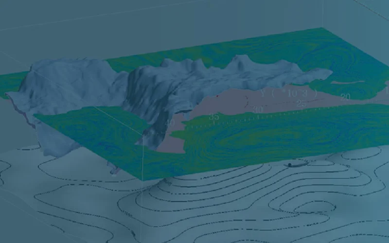
Five earth models were generated in SEAM Phase I to simulate a realistic earth model of a salt canopy region of the Gulf of Mexico complete with fine-scale stratigraphy that includes oil and gas reservoirs. The model represents a 35 km EW x 40 km NS area that is 15 km deep. The grid interval for the Elastic Earth model is 20 m x 20 m x 10 m (x,y,z). All model properties are derived from fundamental rock properties including v-shale (volume of shale) and porosities for sand and shale that follow typical compaction gradients below water bottom. Hence, properties have subtle contrasts at macro-layer boundaries, especially in the shallow section, generating very realistic synthetic data.
The Elastic Earth Model distribution is the model used for simulation of the SEAM Phase I RPSEA elastic data set. For the simulations, the minimum S-wave velocity was set at 600 m/s by compressing all S-wave velocities in the originally designed model having velocities between 100 and 800 m/s into a range between 600 and 800 m/s. This distribution has 3 binary files, one each for the density, P-wave velocity and the S-wave velocity. A README is also included.
This model 2D sub-set is 35KM in the east-west direction at North 23900 m. It is designed to be used with data sets:
- Elastic 2DEW Classic
- Elastic VSP – 2D Walk-Away
Size: 34 MB
Phase I – Elastic 2DEW Classic
This 2D East-West dataset contains all the traces and all the shots along North location 23900. The data is split-spread and contains receivers from East 0 to East 22500 m at an interval of 25 m making a total of 901 receivers per shot. There are 151 shots from East 3700 m to East 18700 m at an interval of 100 m. Traces are pressure recorded 15 m below the non-absorbing sea surface. Each trace contains 2001 samples at 8ms interval for a total length of 16 seconds.
All simulations covered the region within the SEAM model only. No traces were collected outside the model boundaries
Size: 1.1 GB

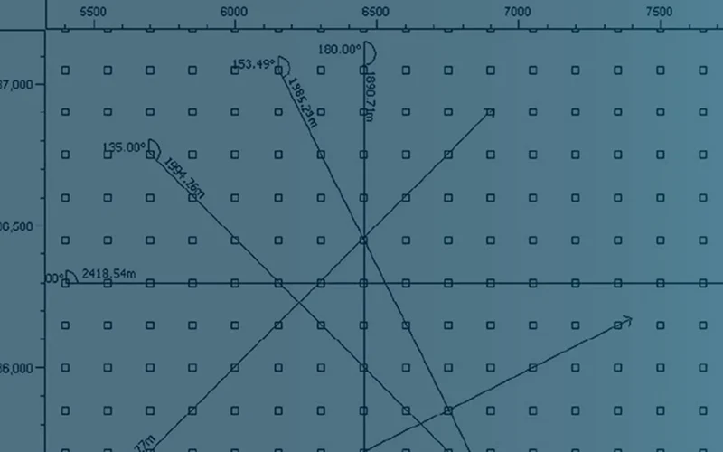
Phase I – Elastic VSP – 2D Walk-Away
This 2D walk-away VSP for well number 1 contains 4-component data. Well 1 is located at North 23900 m and East 10075 m. There are 151 EW shots along North 23900 m into 467 down hole 4 component receivers from a depth of 1000 – 7990 meters incrementing by 15 m. The 151 shots are from East 3700 m to East 18700 m at an interval of 100 m. In effect, the shots walk-away to both the West and East directions from the well. The shots are initiated 15 m below the non-absorbing sea surface. 4 traces per level are pressure and 3-components of particle acceleration. Each trace contains 2001 samples at 8ms interval for a total length of 16 seconds.
Data are not compressed and are delivered in SEGY format. All simulations covered the region within the SEAM model only. No traces were collected outside the model boundaries.
Size: 2.33 GB

Phase I – Well Logs
Well logs were extracted from a specific node within the model that was built on a 20x20m grid and sampled every 10m in depth. Each well contains 21 properties.
Well Log locations are:
East 10080 | North 23900 m
East 12020 | North 23900 m
East 15020 | North 23900 m
East 27020 | North 23900 m
East 15020 | North 22900 m
Data are not compressed and are delivered in SEGY format. All simulations covered the region within the SEAM model only. No traces were collected outside the model boundaries.
Size: 600 KB
“As geophysicists we coax the Earth to reveal its secrets a measure at a time, via the interplay of data and models. But because the Earth is cleverer than you are, effective modeling requires a geovillage of experts from various disciplines. SEAM actively engages its project members and pools their expertise in a collegial atmosphere toward the construction of rigorous earth models and their associated synthetic datasets.”
– Joe Stefani, Graywacke Geophysics
Ready to explore SEAM Open Data? Start your download and accelerate your research today.
Get in Touch